elegant energy for the future
Cooloola Solar Systems
Remembering Black Saturday 2009
Black Saturday — A Sky That Told a Story
February 7, 2009. A date etched into the Australian consciousness.
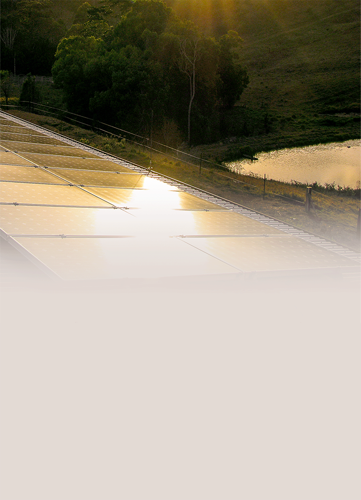
On a February morning in 2009, we were on a shed roof in Kin Kin, Queensland, installing extra solar panels for a standalone system. It was the kind of day that felt different before you could explain why. The sky to the south had taken on a strange quality — bruised, amber, the sun pressing through a veil of red that didn’t belong to our skies. We didn’t know it yet, but what we were witnessing, some 800 to 900 kilometres northeast of Melbourne, was the smoke and light of one of the most catastrophic fire events in recorded history, carried northward within 24 to 48 hours of ignition. The Bureau of Meteorology and satellite imagery from the period confirm exactly that — smoke from the Black Saturday fires was detectable across coastal and elevated areas of Queensland within two days of the fires taking hold.
That moment on the rooftop has stayed with us. It is part of why we feel compelled, seventeen years on, to mark this anniversary — not to dwell on the terrible toll, which is well documented elsewhere, but to reflect on what came before. On the slow, merciless build-up of conditions that made that day possible.
The Land Was Already Burning Inside
Australia has always been a fire continent. Its eucalypt forests evolved with fire, and for tens of thousands of years, First Nations peoples managed the land with careful, low-intensity cultural burning that kept fuel loads in balance. The disruption of those practices after colonisation fundamentally changed how Australia’s vegetation accumulated over time — more densely, more dangerously, more ready to ignite under the right conditions.
By the time 7 February 2009 arrived, the right conditions had been building for over a decade.
The Millennium Drought — one of the most prolonged dry periods in southeastern Australia’s recorded history — had been grinding through Victoria and much of the continent since the late 1990s. By the time Black Saturday came, many parts of Victoria had recorded their lowest rainfall across a twelve-year period ever measured. The Bureau of Meteorology later noted that the rainfall deficit over that time was the equivalent of two full years of average rainfall simply never arriving. Melbourne itself had not seen rain for 35 days leading into that week — equal second-longest dry spell on record. The landscape was not just dry. It was desiccated to a depth and completeness that made it fundamentally different from any drought that had preceded it.
The dead bark peeling from eucalypts, the carpets of dry leaf litter, the brittle understorey shrubs — all of it had been curing in place for months and years. Scientists describe this as “fuel load.” By February 2009, the fuel loads across Victoria’s forests were extraordinary. The bush was, in essence, a landscape of kindling waiting for a spark.
A Catastrophic Confluence of Conditions
The drought alone would not have made Black Saturday what it was. What turned tinder into tragedy was the simultaneous arrival of multiple extreme weather systems, each compounding the others.
In the weeks before 7 February, a severe heatwave had already punished southeastern Australia. Melbourne recorded three consecutive days above 43°C — an event with no precedent in the city’s 154-year weather record. On 7 February itself, temperatures peaked at 46.4°C in Melbourne, shattering the previous all-time record. Geelong reached 47.4°C. More than 87 percent of Victoria recorded its highest temperature on that single day.
The Bureau of Meteorology explained the meteorological mechanics behind the heat: a slow-moving high-pressure system in the Tasman Sea, an intense tropical low off Western Australia’s northwest coast, and an active northern monsoon all aligned to channel superheated air from the interior directly southward into Victoria. This was not ordinary summer heat. It was heat with force and direction behind it.
Then came the winds. Ahead of an incoming cool change, strong northwesterly winds exceeding 100 km/h scoured the state, drawing hot, dry air from deep in the continent’s interior. These winds drove fires before them with terrifying speed. And then, in the afternoon, the cool change arrived — but it brought no relief. The southwesterly winds behind the change were themselves gale-force, hitting the relatively narrow eastern flanks of established fire fronts broadside. Fire lines that had been running in one direction were suddenly transformed. What had been a flank became a front. Fires that had seemed containable became catastrophic within minutes.
The McArthur Forest Fire Danger Index — the standard Australian measure of fire weather conditions — simply went off the scale that day. It was designed with an upper limit of 100. On Black Saturday, conditions in parts of Victoria exceeded 200. No planning framework, no modelling tool, had ever seriously been required to account for numbers like that.
When Fire Creates Its Own Weather
One of the most chilling aspects of the Black Saturday fires was behaviour that even experienced firefighters had never seen. Fires began generating their own weather — pyroconvective events where the heat and energy of the fire itself created towering storm columns, propelling burning embers 35 kilometres ahead of the main front. These started new fires in places that should have been safe, that people believed were safe.
Flame heights in some areas reached more than 30 metres. Fire temperatures in the eucalypt forests exceeded 1,200°C, as the volatile oils in the leaves of species like Eucalyptus angustissima became, in effect, an accelerant. The firestorms that resulted have been compared by scientists to the convective dynamics of nuclear events — not in destructive intent, but in the physics of what happens when fire reaches that scale and intensity.
The fires could kill people 400 metres from the flame front. Towns that residents believed would be bypassed were consumed in minutes.
Seen From a Rooftop in Kin Kin
A Sky Full of Warning, Seen From a Rooftop in Kin Kin
Standing on that rooftop in southeast Queensland, looking at a sun turned blood-red and a sky the colour of old rust, we were witnessing the outer edge of something unimaginable happening far to the south. The smoke from a disaster 900 kilometres away had reached us within two days.
It was our first indication that something immense and terrible was unfolding. We didn’t have the words for it yet. We didn’t know the names of the towns that were already gone.
What happened on 7 February 2009 was not simply a fire. It was the product of a decade of drought, decades of accumulated fuel, a once-in-a-generation alignment of heat and wind, an infrastructure failure, and a set of fire behaviour dynamics that overwhelmed everything in their path. It was a tragedy that forced a nation to fundamentally reconsider how it prepares for, responds to, and lives alongside the reality of fire in this continent.
Much has changed in the seventeen years since. Emergency systems have been reformed, warning frameworks rebuilt, research into fire behaviour deepened. But the underlying conditions that made Black Saturday possible — the drying of the climate, the accumulation of fuel, the intensification of weather extremes — have not gone away. They have, in many respects, continued to deepen.
We share this as a memorial — to those who were lost, to the communities who rebuilt, and to the quiet, terrible sky we watched from a rooftop in Kin Kin, not yet knowing what it meant.
Further Reading and Official Resources
For those who wish to learn more about the events of Black Saturday, the following are authoritative sources:
- Bureau of Meteorology — “Remembering Black Saturday: the extraordinary weather behind Victoria’s 2009 bushfires” https://media.bom.gov.au/social/blog/2025/remembering-black-saturday-the-extraordinary-weather-behind-victorias-2009-bushfires/
- 2009 Victorian Bushfires Royal Commission — Final Report Available via: https://www.royalcommission.vic.gov.au/
- Country Fire Authority (CFA) — Black Saturday 2009 https://www.cfa.vic.gov.au/about-us/history-major-fires/major-fires/black-saturday-2009
- National Museum of Australia — Black Saturday Bushfires https://www.nma.gov.au/defining-moments/resources/black-saturday-bushfires
- Australian Disaster Resilience Knowledge Hub — Black Saturday, Victoria, 2009 https://knowledge.aidr.org.au/resources/bushfire-black-saturday-victoria-2009/
- Britannica — Black Saturday Bushfires https://www.britannica.com/event/Black-Saturday-bushfires-Australia-2009
Written by the team at Cooloola Solar Systems, installing Stand Alone Systems, Gympie-Cooloola region, Queensland. The photograph used as our site background was taken by us from the rooftop in Kin Kin on 7 February 2009 — the red sky that first told us something was terribly wrong far to the south.